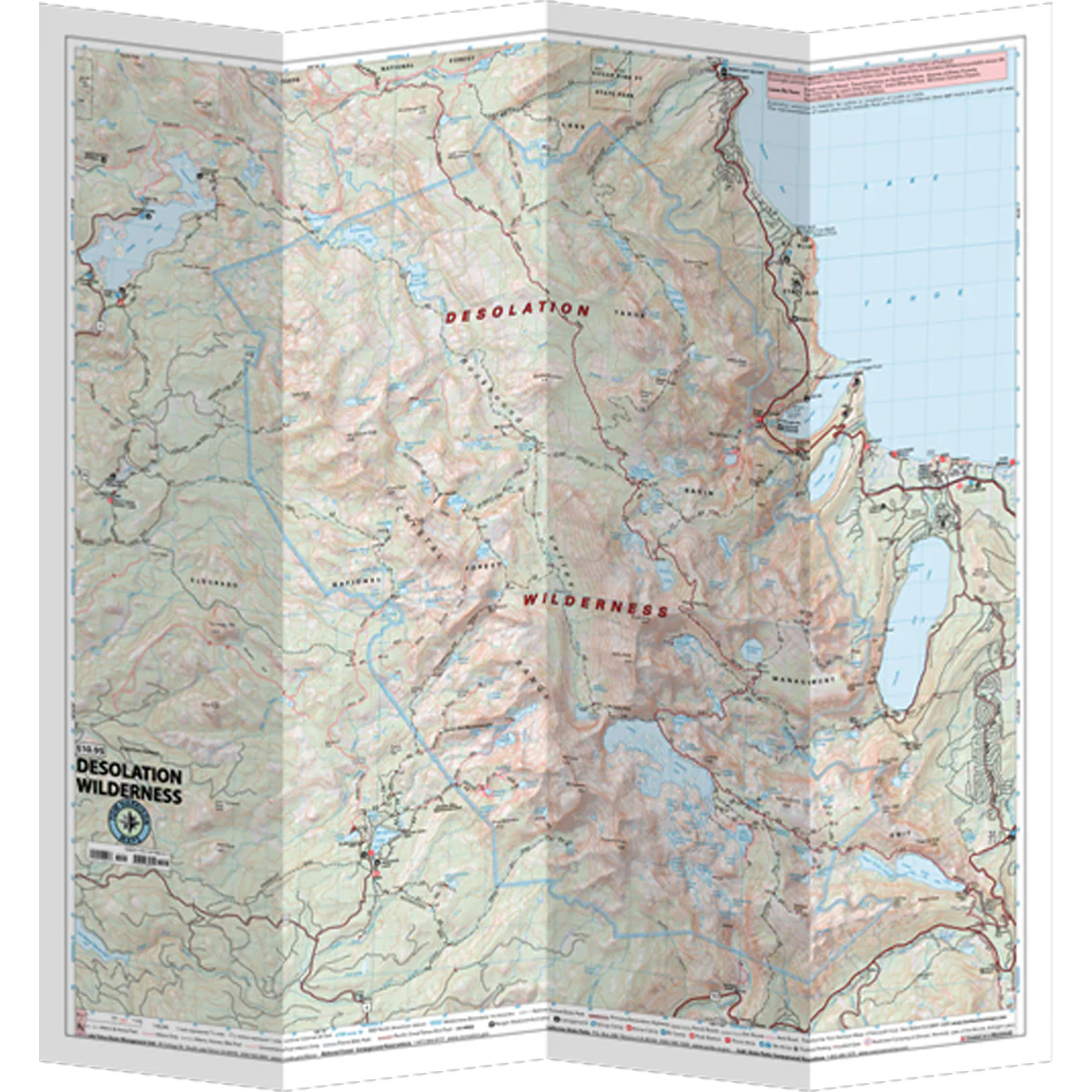
Desolation Wilderness
The Desolation Wilderness Map shows the premiere backpacking area in the Lake Tahoe Basin. Includes trail mileage, elevation points and zone boundaries. Permits are required for both Day-Use and Overnight. Day-Use permits are free and are available for self-registration at major trailheads. There are 9 westside trailheads, and 6 eastside trailheads.
- Pub. 2025
- Scale 1:42,240
- 40 ft contours
- Water-proof and tear resistant
- Full-color and light-weight
- Shaded-relief topography
- Color-coded symbols and trails
- Mileages between trail junctions
- Latitude/longitude
- UTM grids
- Contour lines
- Vegetation
- Elevations at trail junctions
Original: $12.95
-70%$12.95
$3.88Description
The Desolation Wilderness Map shows the premiere backpacking area in the Lake Tahoe Basin. Includes trail mileage, elevation points and zone boundaries. Permits are required for both Day-Use and Overnight. Day-Use permits are free and are available for self-registration at major trailheads. There are 9 westside trailheads, and 6 eastside trailheads.
- Pub. 2025
- Scale 1:42,240
- 40 ft contours
- Water-proof and tear resistant
- Full-color and light-weight
- Shaded-relief topography
- Color-coded symbols and trails
- Mileages between trail junctions
- Latitude/longitude
- UTM grids
- Contour lines
- Vegetation
- Elevations at trail junctions